Post by Jessie Desmond on Apr 27, 2016 12:47:20 GMT -9
Ogliuga Army Airfield, Ogliuga Island, AK
51.606, -178.656 (Southwest of Anchorage, AK)
Ogliuga Island is located at the far western end of the Aleutian Island chain, being located closer to mainland Russia than mainland Alaska.
According to Wikipedia, “Ogliuga Island AAF was established in 1942 as a result of the Japanese invasion of the Aleutian Islands. Its primary use was as an emergency landing field by USAAF & Naval Air aircraft during the campaign, not having any permanent units assigned.”
According to the U.S. Navy's “Building the Navy's Bases in World War II, “Construction of the emergency landing field established at Ogliuga for the Army in July 1943, was performed entirely by Seabees. A 3,000' x 100' runway & four 100'-square parking areas were constructed, with a surface of steel matting. The only other construction at Ogliuga was a small building for living quarters.” It has not been determined if Ogliuga Island AAF was ever actually used by any aircraft.
According to Wikipedia, Ogliuga Island AAF “was abandoned after World War II.”
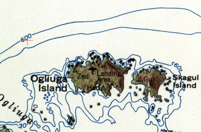
The earliest depiction which has been located of Ogliuga Island AAF was on the 1951 USGS topo map, which labeled it simply as “Landing Area”.
Amchitka Army Airfield / Naval Air Facility Amchitka / Amchitka Air Force Base, Amchitka Island, AK
51.38, 179.27 (Southwest of Anchorage, AK)
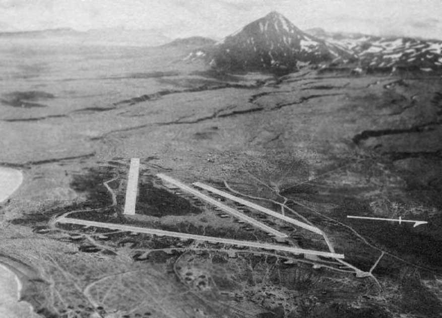
According to Wikipedia, American forces made an initially unopposed landing on Amchitka Island on 1/12/43. Despite facing difficult weather conditions and continual bombing attacks from the Japanese, Army engineers managed to build a runway. As more troops were landed, heavy construction equipment was brought ashore. Frozen lakes were drained & the gravel scraped from their beds was used to lay down the bed for a runway. On 2/16/43 the construction of the first runway at Amchitka (Code Name A-3, oriented east/west) had progressed to the point where light fighters could be brought in. This airfield was also known as “Fox”, according to the University of AK Fairbanks. Eighteenth Fighter Squadron Curtis P-40 Warhawks began to arrive from Adak & surprised the Japanese by launching counter-attacks to their raids from Kiska. Two Japanese light bombers were shot down over the airfield in full view of the construction engineers. In addition to the P-40s, several Lockheed P-38 Lightnings arrived.
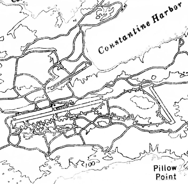
To the north of the main World War II runway were constructed a large number of roads & Quonset huts, and possible temporary aircraft maintenance hangars. To the south of the main World War II runway were constructed numerous taxiways & a large number of aircraft revetments, likely dating from the Aleutian Campaign. The aircraft parking was dispersed over a wide area almost to the south shore of the island connected by a taxiway & road network. As the airfield was attacked on several occasions by Japanese aircraft, the wide dispersal was needed for defense. Also constructed were a large number of anti-aircraft artillery sites, ammo dumps & other facilities.
The adverse weather conditions included much fog & this caused the loss of many aircraft. To counter this Fog Investigation & Dispersal Operation (FIDO) was installed on runway Baker (the bomber runway) and it became operational in mid-June 1944. It was used on several occasions, allowing successful take-off & landing in foggy conditions that would otherwise have prevented safe operations.
With its establishment, the Alaska Command was now 50 miles away from their target, Kiska. The military eventually built numerous buildings, roads, and a total of 3 airstrips on the island. At its peak, the occupancy of Amchitka Army Airfield reached 15,000 troops.
Known USAAF units assigned to Amchitka AAF were:
- HQ IX Bomber Command, 6/24-9/4/43, HQ 343rd Fighter Group,
- 7/25/43–1/22/44, 11th Fighter Squadron, 3/27-5/17/43 & 3/23/44-July 1945 (P-40 Warhawk),
- 18th Fighter Squadron, 2/15/43-3/28/44 (P-40 Warhawk & P-38 Lightning),
- 54th Fighter Squadron, 3/12-10/18/43 (P-38 Lightning),
- 344th Fighter Squadron, May-July 1943 (P-40 Warhawk & P-38 Lightning),
- 632rd Bombardment Squadron (Dive), 7/19-8/1543 (A-24 Banshee),
- 633rd Bombardment Squadron (Dive), 7/19-8/15/43 (A-24 Banshee),
- 635th Bombardment Squadron (Dive), 7/19-8/15/43 (A-24 Banshee),
- 21st Bombardment Squadron, 2/18 - July 1943 (LB-30 & B-24 Liberator),
- 36th Bombardment Squadron, 5/4-9/13/43 (B-24 Liberator),
- 73rd Bombardment Squadron, March–April 1943; 6/30 - August 1943 (B-25 Mitchell & B-26 Marauder),
- 77th Bombardment Squadron, 9/11/43-2/11/44 (B-25 Mitchell & B-26 Marauder),
- 404th Bombardment Squadron, 6/4/43-2/26/44 (B-24 Liberator).
Western Shemya Army Airfield, Shemya Island, AK
52.72, -174.08 (Southwest of Anchorage, AK)
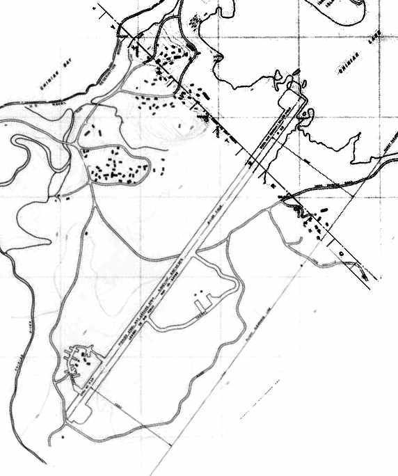
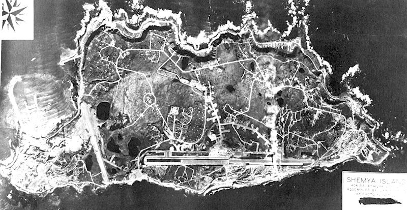
Shemya Island is one of the western-most American islands of the Aluetian Island chain, being located closer to mainland Russia (438 NM) than mainland Alaska. On 5/28/43, a small detachment of Alaskan Scouts began reconnaissance of Shemya. The following day, United States Army Engineers came ashore to begin construction of a runway suitable for B-29 Superfortress bombers. Tents were erected, a rudimentary electrical system, radios and some rough streets were laid down. A 10,000' east/west runway was constructed on the eastern portion of the island, along with a 5,000' north/south runway on the western portion.
A wide variety of aircraft flew from Shemya during WW2, but it is presumed the majority of these operated from the primary airfield on the eastern end of the island. It is not known what specific purpose the western airfield served, other than presumably serving smaller aircraft (fighters), leaving bombers to the larger airfield on the east end of the island.
With the exception of a small station housekeeping unit, Shemya was abandoned after WW2. The island was littered with abandoned Army & Navy aircraft wrecks & deteriorating station structures. Abandoned vehicles, warehouse stores of all types, rations, clothing & all the other tools of war, including ammunition & bombs were simply left out to the elements. For a time the Air Force considered transferring the island to the Civil Aeronautics Administration. However, the Air Force decided to retain Shemya because its location provided an ideal refueling stop on the Great Circle Route from Japan to Washington State.
The earliest depiction which has been located of the western Shemya airfield was a 1944 aerial view, which depicted one north/south runway on the western part of the island, along with the much longer east/west runway on the eastern part of the island.

